Weather Fronts
A weather front is an area where two air masses meet. Use the tabs below to learn more about each type of front.
A cold front occurs where an advancing colder air mass replaces a warmer air mass.The colder, denser air undercuts the warmer, less dense air ahead of it, which results in the warmer air rising into the atmosphere. The warm, rising air usually means clouds, and oftentimes precipitation. If the cold front advances fast enough, it can create strong thunderstorms. Cold fronts generally move from west to east and/or from north to south in the U.S. A cold front is represented by blue triangles on a weather map.
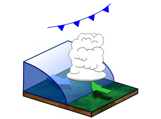
Source: Air Masses | NWS
A warm front occurs when a cold air mass is receding and is being replaced by a warmer air mass. Warm air is less dense, so it rides over the cooler air mass, which results in a “top-down” erosion of the cooler air mass. Weather along warm fronts can range from just a few clouds to precipitation. Warm fronts generally move from the south to the north in the U.S. and are represented by red semicircles on a weather map.
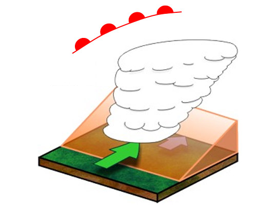
Source: Air Masses | NWS
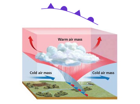
Cold fronts usually advance faster than warm fronts. When a cold front catches up to a warm front, they merge and become an occluded front. Because the cold air behind the cold front meets the cold air ahead of the warm front, it is difficult to “feel” this boundary at the surface but these fronts can bring clouds and precipitation. Occluded fronts are represented by alternating purple triangles and semicircles on the same side.
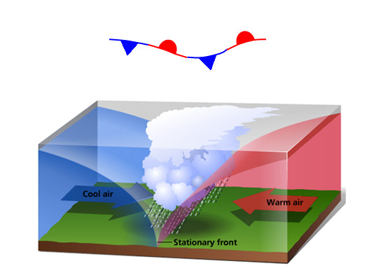
A stationary front is a front that does not move. Even though the air masses do not advance, they still may move parallel to the orientation of the stationary front and high amounts of precipitation can fall, sometimes resulting in flooding events. A stationary front is represented by alternating red semi-circles and a blue triangles on opposite sides.
Source: differentfronts.weebly.com