How Does the 540 Line Work?
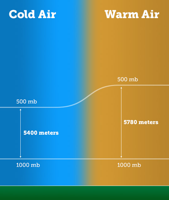
Because warm air takes up more space than cold air, forecasters look between the pressure levels of 1000 and 500 millibars, because this layer is a good indicator of the temperature of the atmosphere. Since cold air is denser, the distance (also known as thickness) between the two levels is smaller than it would be in warm air.
Typically, when the distance between these two pressure levels is less than ‘540’, or 5400 meters, it means that the air is below freezing and cold enough for all precipitation to fall as snow.
Sometimes there are areas of warm air under the cold layer that can change the type of precipitation that is observed.

Source: WeatherSTEM