Geography
Source: Tennessee Relief 1 | EROS
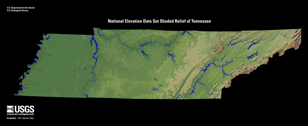
Many geographic features help determine the climate and weather events that impact Tennessee. There are nine principal physiographic divisions across the state. From east to west, they are the Unaka Mountains, Great Valley of East Tennessee, Cumberland Plateau, Eastern Highland Rim, Central Basin, Western Highland Rim, Western Valley, Plateau Slope of West Tennessee and the Mississippi River Flood Plain.
Tennessee stretches from 34° 59' N to 36° 41' N (Latitude) and 81° 39' W to 90° 19' W (Longitude); which makes the state roughly 120 miles wide and 440 miles long.
Only 2.2% of the area of the state is considered water. Some of the major lakes in the state are the Kentucky Lake, Norris Lake, Chickamauga Lake, Cherokee Lakes and Tims Ford Reservoir. Major river systems include the Tennessee, Mississippi, Cumberland, Clinch, and Duck rivers.
Elevation changes across the state range from 178 ft., along the Mississippi River, to the highest point at Clingmans Dome (6,6,43 ft.) in Sevier County.
The prevailing westerly winds are found between 30°N and 60°N, and these prevailing winds help steer large-scale weather systems and have a significant impact on the weather and climate of Tennessee. Winds are primarily out of the southwest during the summer and from the northwest during the winter.