Geography
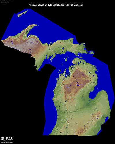
There are many geographic features that help determine the climate and weather events that are seen across Michigan. Five principal physiographic divisions are particularly well defined in Michigan. From north to south, Crystalline Uplands, Eastern Lowlands, High Plains, Hilly Moraines and Beaches/Dunes.
Michigan stretches from 41° 41' N to 48° 18' N (Latitude) and 82° 07' W to 90° 25' W (Longitude); which makes the state roughly 386 miles wide and 456 miles long.
41.5% of the area of the state is considered water. The state’s shoreline spans over 3,000 miles along The Great Lakes; including Lake Erie, Lake Huron, Lake Michigan and Lake Superior. Lake St. Clair is one of the major lakes within the state, and some of the major river systems include the Detroit, Grand, Kalamazoo, St. Clair and St. Mary's rivers.
Elevation changes across the state range from 571 ft. along the Lake Erie to the highest point at Mount Arvon (1,979 ft.) in Baraga County.
The prevailing westerly winds are found between 30°N and 60°N, and these prevailing winds help steer large-scale weather systems and have a large impact on the weather and climate of Michigan. Winds are primarily out of the southwest during the summer and from the northwest during the winter.
Source: Michigan Relief 1 | EROS