Geography
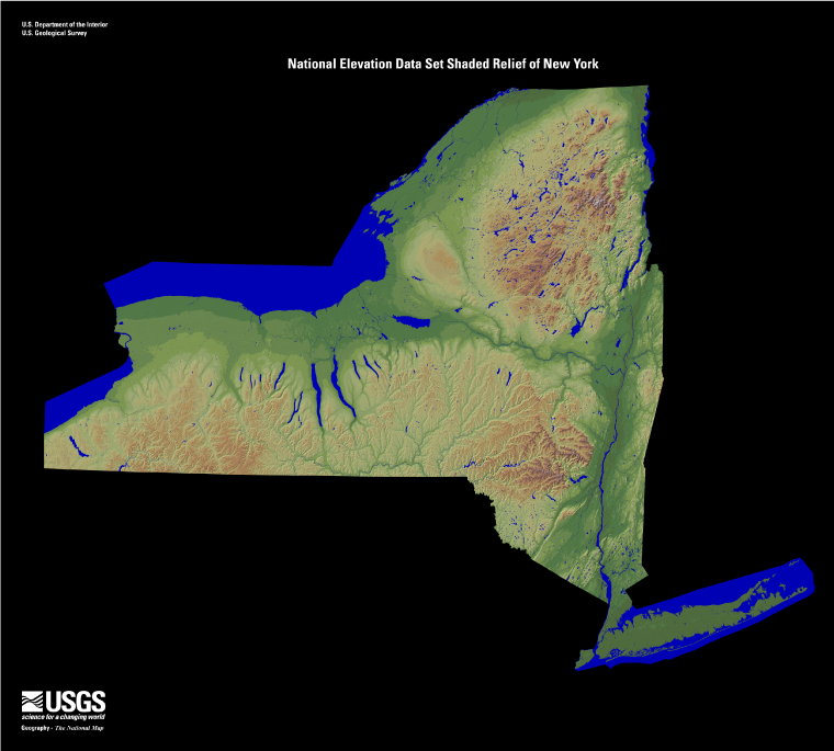
Many geographic features help determine the climate and weather events that are seen across New York. There are two principal physiographic regions and separate divisions that are well defined in New York. They consist of the Highlands (Adirondack Mountains, Allegheny Plateau, Catskill Mountains, Hudson Highlands, Taconic Mountains, and Tug Hill Plateau) and Lowlands (Atlantic Coastal Plains, Erie-Ontario Lowlands, Hudson-Mohawk Lowlands, Newark Lowlands, and St. Lawrence-Champlain Lowlands).
New York stretches from 40° 30 N to 45° 10′ N (Latitude) and 71° 51′ W to 79° 46′ W (Longitude); which makes the state roughly 285 miles wide and 330 miles long.
13.5% of the area of the state is considered water. Some of the major lakes within the state are Lake Erie, Lake Ontario, Lake Champlain, the Finger Lakes, and Lake St. Francis. Major river systems include the Hudson, Mohawk, Susquehanna, and St. Lawrence rivers.
Elevation Changes: Elevation Changes: Elevation changes across the state range from sea level along the Atlantic Ocean to the highest point at Mount Mercy (5,344 ft.) in Essex County.
The prevailing westerly winds are found between 30°N and 60°N, and these prevailing winds help steer large scale weather systems and have a large impact on the weather and climate of New York. Winds are primarily out of the southwest during the summer and from the northwest during the winter.
Source: New York Relief 1 | EROS