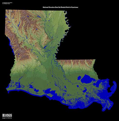
Geography
Louisiana is ranked as the 31st largest state in the United States by area, which a population of 4.7 million people (25th). Many geographic features help determine the climate and weather events that are seen across the state. There are three central physiographic regions defined in Louisiana. They consist of the East Coast Plain, the Mississippi Alluvial Plain, and the West Gulf Coastal Plain.
Louisiana stretches from 28° 56' N to 33° 01′ N (Latitude) and 88° 49′ W
to 94° 03′ W (Longitude). Which makes the state roughly 130 miles wide and
379 miles long.
Fifteen percent of the area of the state is considered water, though the state
has more than 80,000 miles of waterways. Some of the major lakes within the state
are Lake Pontchartrain, Lake Borgne, Lake Maurepas, and Toledo Bend Reservoir. Major
river systems include the Mississippi, Red, Ouachita, Sabine and Pearl rivers.
Elevation changes across the state range from the lowest point, New
Orleans which is eight feet (8 ft.) below sea level to the highest point
at Driskill Mountain (535 ft.) near Bryceland in Bienville Parish.
The prevailing westerly winds are found between 30˚N and 60˚N, while
the easterly trade winds are located between the equator and 30˚N.
These prevailing winds help steer large scale weather systems and
have a significant impact on the weather and climate of portions of
Louisiana.
Source: Louisiana Relief 1 | EROS