Geography
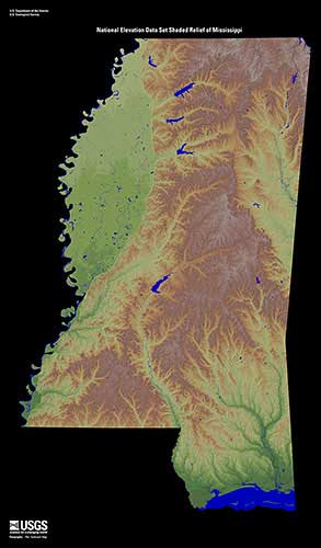
Mississippi is ranked as the 32nd largest state in the United States by area and has a population of 2.9 million (25th in the nation). Many geographic features help determine the climate and weather events that are seen across the state. Two physiographic regions are defined in Mississippi: the East Gulf Coastal Plain and the Mississippi Alluvial Plain.
Mississippi stretches from 30° 12' N to 35° 00′ N (Latitude) and 88° 06′ W to 91° 39′ W (Longitude), meaning the state is roughly 170
miles wide and 340 miles long.
Only three percent of the area of the state is considered water, though the state has more than 80,000 miles of waterways. Some major
lakes within the state are Grenada Lake, Ross Barnett Reservoir, and Sardis Lake. Major river systems include the Big Black, Mississippi,
Pearl, Pascagoula, Tombigbee, and Yazoo.
Elevation changes across the state range from sea level along the state's 44-mile coastline to the highest point at Woodall Mountain (806 ft.) near Iuka in Tishomingo Parish.
The prevailing westerly winds are found between 30˚N and 60˚N, while the easterly trade winds are located between the equator and 30˚N. These prevailing winds help steer
large-scale weather systems and have a significant impact on the weather and climate of portions of Mississippi.

Source: Mississippi Relief Map | EROS