Geography
Source: Geology of Virginia | Radford.edu | C. Bailey
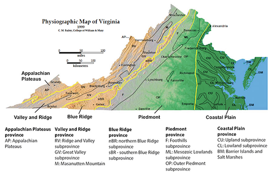
There are many geographic features that help determine the climate and weather events that are seen across Virginia. There are five principal physiographic divisions that are particularly well defined in Virginia. From east to west, they are the Coastal Plain, the Piedmont, Blue Ridge, Valley and Ridge, and the Appalachian Plateaus.
Virginia stretches from 36° 32' N to 39° 28' N (Latitude) and 75° 15' W to 83° 41' W(Longitude). Which makes the state roughly 200 miles wide and 430 miles long.
Bodies of Water: Only 7.4% of the area of the state is considered water. The state’s coastline spans 112 miles along the Atlantic Ocean. Some of the major lakes within the state are: Kerr Lake, Smith Mountain Lake, Lake Anna and Lake Chesdin. Major river systems include the Potomac-Shenandoah, Rappahannock, York, James, Roanoke, Chowan, New, Tennessee and Big Sandy.
Elevation Changes: Elevation changes across the state range from sea level along the Coastal Plain to the highest point at Mount Rogers (5,729 ft.) in Grayson County.
Prevailing Winds: The westerly prevailing winds are found between 30°N and 60°N, and these prevailing winds help steer large scale weather systems and have a large impact on the weather and climate of Virginia. Winds are primarily out of the southwest during the summer and from the northwest during the winter.
