Keeping an Eye on the Oceans
Source: GOES Imagery Viewer | NOAA
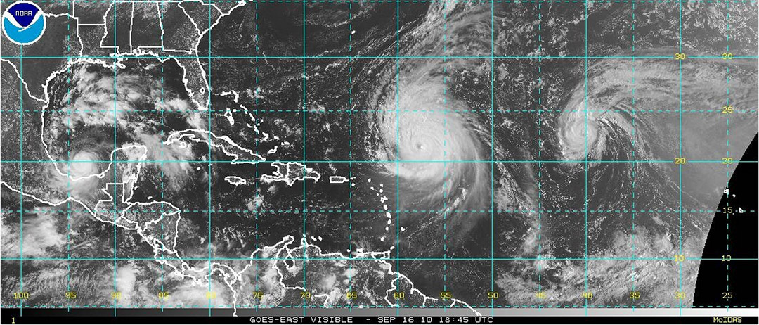
Since tropical storms and hurricanes form over the ocean, meteorologists must rely heavily on satellite images and buoy observations for the data they need to forecast. This image from NASA shows several tropical storm systems in the Atlantic Ocean and Gulf of Mexico.