Bathymetry
Source: Poster: Bathymetry of the Northern Gulf of Mexico & Atlantic Coast East of Florida | NOAA
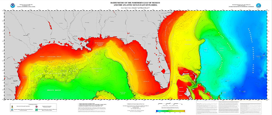
The depth of the water can also play a vital role in the formation, movement, and breaking of waves. Bathymetry refers to the study of the ocean’s depth relative to sea-level. It is often called “submarine topography.” Bathymetry maps show the land that lies under the water, illustrating variations in the depth and shapes of the terrain or beds. Shallow water cannot handle long period waves. Since these waves result in closeouts (a wave breaking all at once), they are not good for surfing.