Geography
Source: Kentucky Relief 1 | EROS
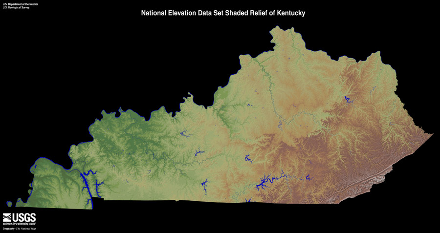
There are many geographic features that help determine the climate and weather events that are seen across Kentucky. There are five principal physiographic divisions that are well defined in Kentucky. From east to west, they are the Eastern Coal Field, the Bluegrass, the Western Coal Field, the Pennyrile and the Mississippi Embayment.
Kentucky stretches from 36° 30 N to 39° 09′ N (Latitude) and 81° 58′ W to 89° 34' W (Longitude). Which makes the state roughly 140 miles wide and 379 miles long.
1.7% of the area of the state is considered water. Some of the major lakes within the state are Lake Cumberland, Kentucky Lake, and Barkley Lake. Major river systems include the Ohio, Mississippi, Cumberland, Kentucky and Green rivers.
Elevation changes across the state range from 275 ft. along the Mississippi River at Kentucky Bend (Fulton County) to the highest point at Black Mountain (4,145 ft.) in Harlan County.
The prevailing westerly winds are found between 30˚N and 60˚N, and these prevailing winds help steer large scale weather systems and have a large impact on the weather and climate of Kentucky. Winds are primarily out of the southwest during the summer and from the northwest during the winter.