River Discharge
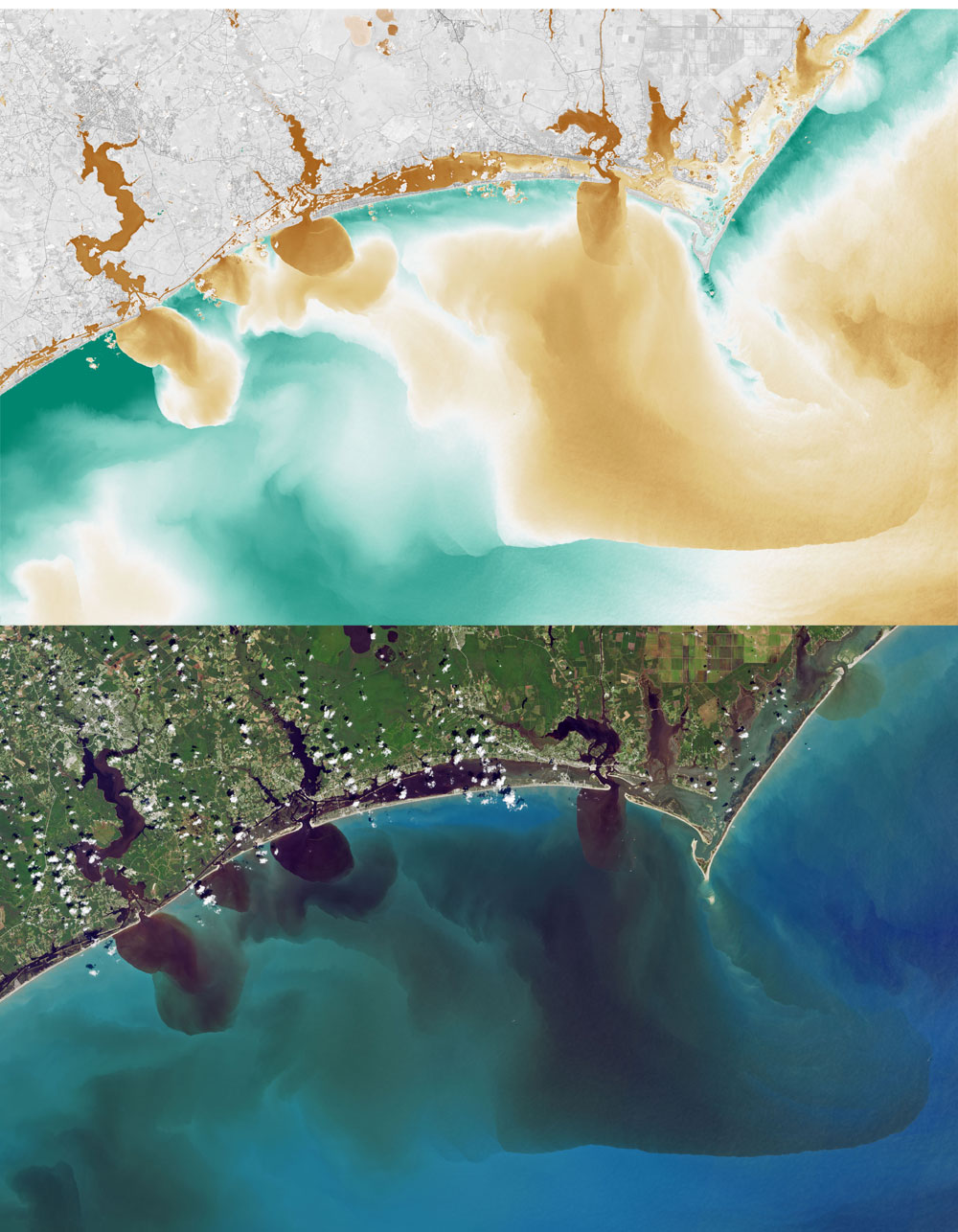
These images from the Landsat 8 satellite show how the flood has affected water quality in the some of the North Carolina rivers, including the White Oak River, New River, Adams Creek, and their outflows along the coast on September 20, 2018. The natural color image shows the discoloration of the water due to soils, sediments, decaying leaves, pollution, and other debris found in the swollen rivers, bays, estuaries, and the nearshore ocean.
The second image combines visible and infrared data from Landsat to reveal the amount of colored dissolved organic matter (CDOM) in those waterways. Organic matter—such as leaves, roots, or bark—contain pigments and chemicals (such as tannins) that can color the water when they dissolve. Depending on the amount of dissolved particles, the water in natural-color imagery can appear blue, green, yellow, or brown as the CDOM concentration increases.