Other Clouds and Optics
In addition to the cloud classifications mentioned in the previous slides, there are other unusual cloud formations and optics. Check out some of these interesting featured captured by our WeatherSTEM cameras.
- Funnels and Spouts
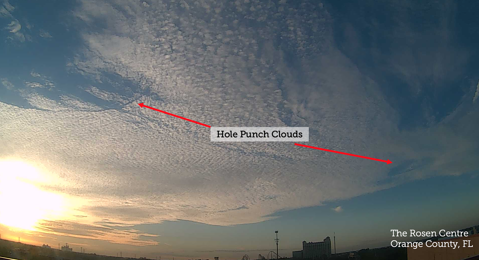
- Hole Punch Clouds
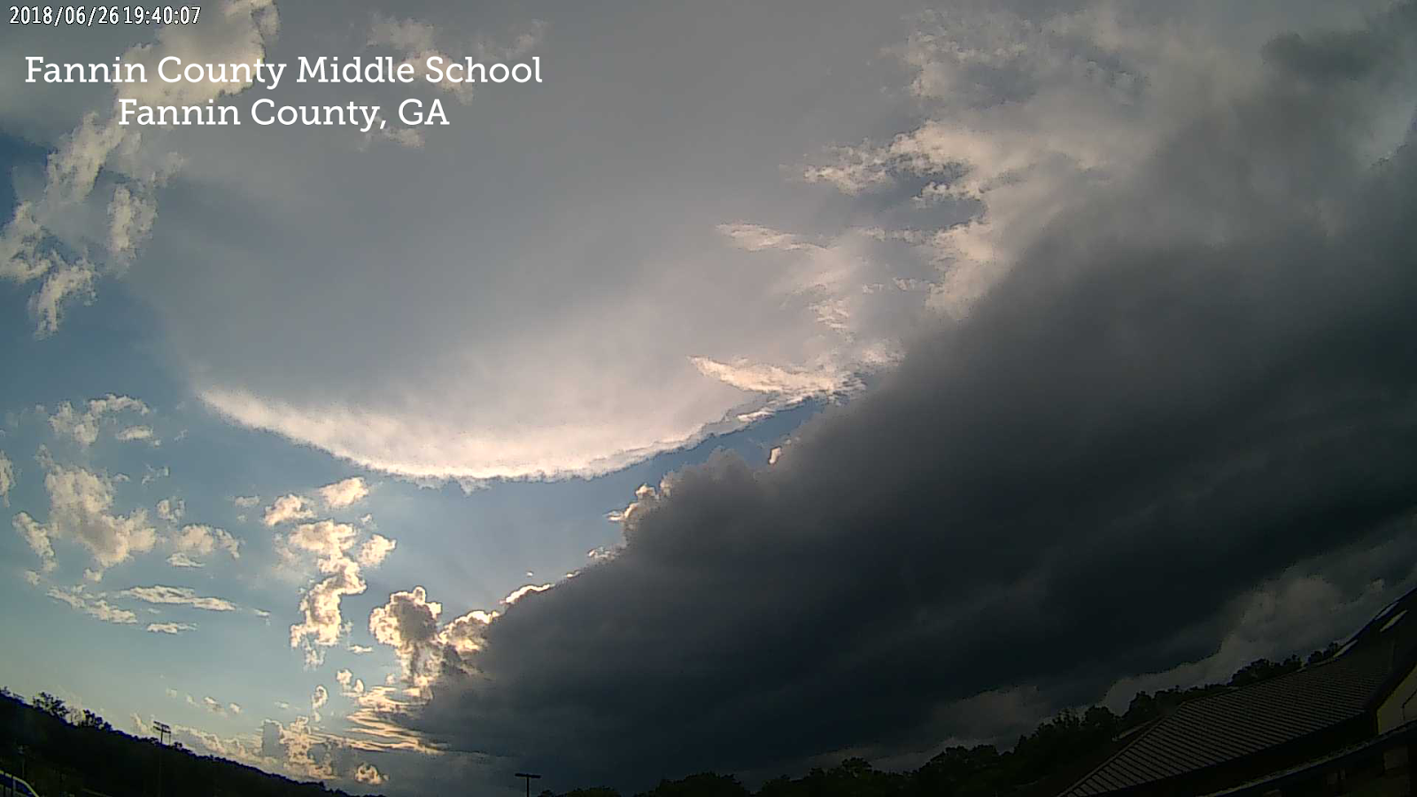
- Shelf Cloud
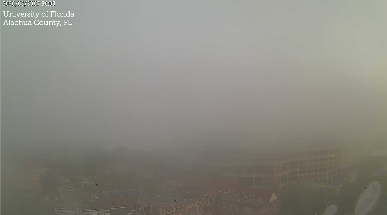
- Fog
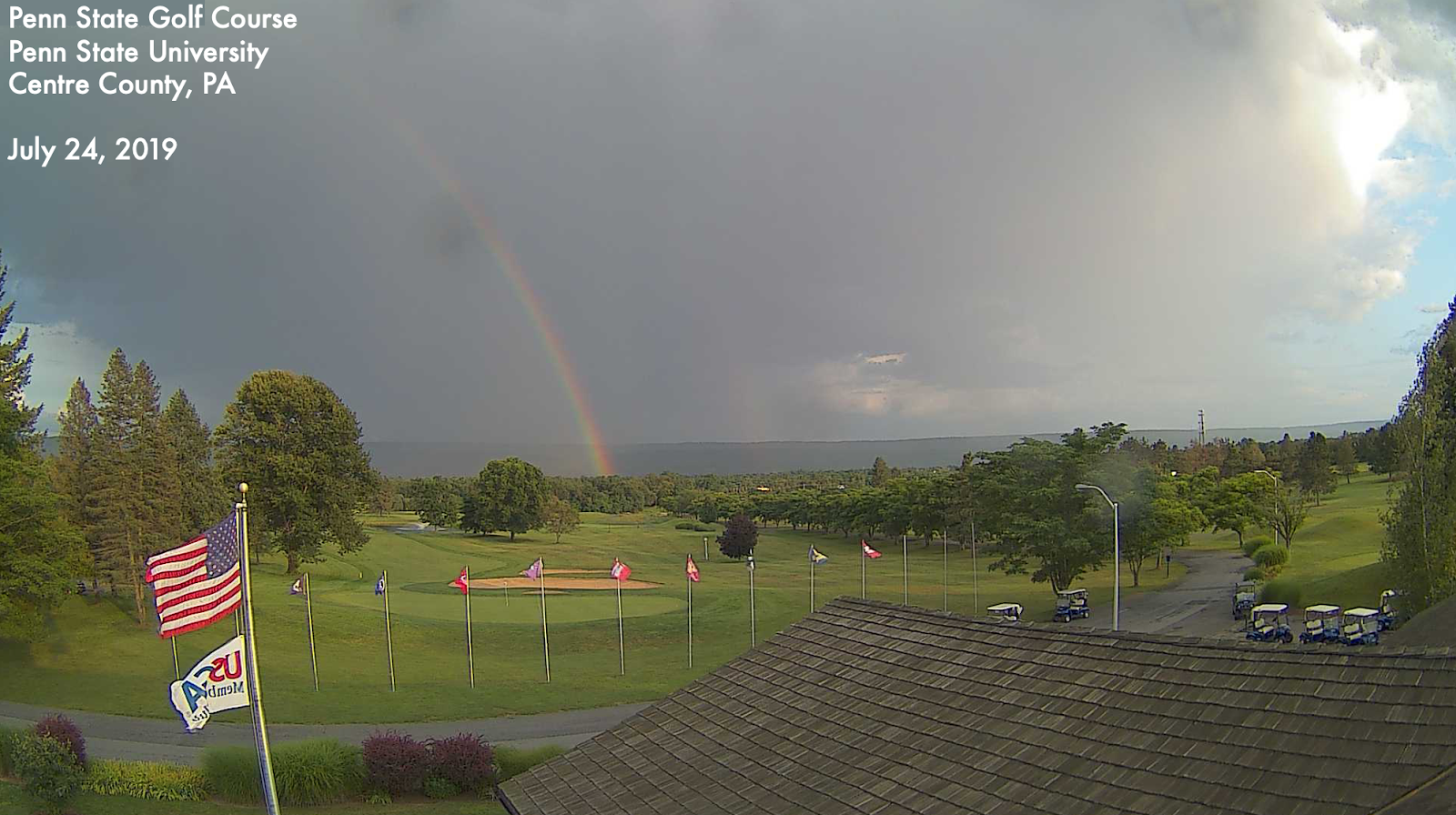
- Rainbow
- Pileus Cloud
- Sun Pillar
- Crepuscular and Anticrepucular Rays
- Sun Dog
Funnels and spouts are special designations of clouds. They are a cloud column or inverted cloud cone, protruding from a cloud base; it constitutes the cloudy manifestation of a more or less intense vortex. Tornadoes are rapidly rotating columns of air that form inside storms and connect the bottom of a thunderstorm to the ground via a funnel cloud.

Also known as fallstreaks, hole-punch clouds are large circular gaps in cirrocumulus or altocumulus clouds. The cumulus clouds are made of supercooled water droplets that have yet to freeze. Once ice crystals are introduced into the cloud layer, the water droplets freeze, and virga or wisps of cirrus fall from the central part of the hole, which grows larger with time.
Shelf clouds are low-hanging, horizontal clouds that form slightly ahead of a thunderstorm or line of thunderstorms. While shelf clouds themselves are harmless, they can be a precursor for potentially dangerous weather- including strong winds and hail, since shelf clouds tend to form ahead of intense thunderstorms.
Fog is water droplets suspended in the air at the Earth's surface, or can also be referred to as a cloud with its base at the ground. Dense fog can cause visibility to drop to less than ¼ mile. Visibility is a measure of the greatest distance an observer can see and identify known prominent objects.
A rainbow is an arc of concentric colored bands that spans the sky when sunlight and water are present. Airborne water droplets such as mist, rain, or spray scatter the sunlight. If the sun is positioned behind the observer (or camera) at a low angle, there is a chance a rainbow could be seen. Rainbows appear in the western sky in the morning, and in the eastern sky during the evening. Rainbows do not exist in a particular place, but due to the rain, sunlight, and the viewer's position is 'just right.'
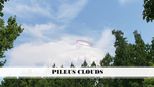
Pileus clouds, also called scarf clouds or cap clouds, are not an unusual cloud formation, but are tough to spot because they tend to be short-lived. Pileus clouds (indicated within the red circles on the pictures) are smooth, wispy clouds found at the top or attached to a growing cumulus tower and are considered an accessory cloud. These clouds develop as warm air rises within a cumulus cloud and push the moist air above it higher. If the air cools past the dew point, the water quickly condenses, producing ice crystals, and the result is a thin, wispy cloud.
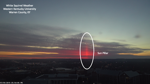
Sun pillars are vertical shafts of light that extend upward or downward from the sun and are typically seen during sunrise or sunset. Sunlight is reflected off tilted hexagonal-shaped ice crystals associated with high-level clouds, such as cirrostratus clouds, to create light streaks. These tiny ice crystals, sometimes called diamond dust, can produce similar pillars from unshielded light sources on frigid nights.
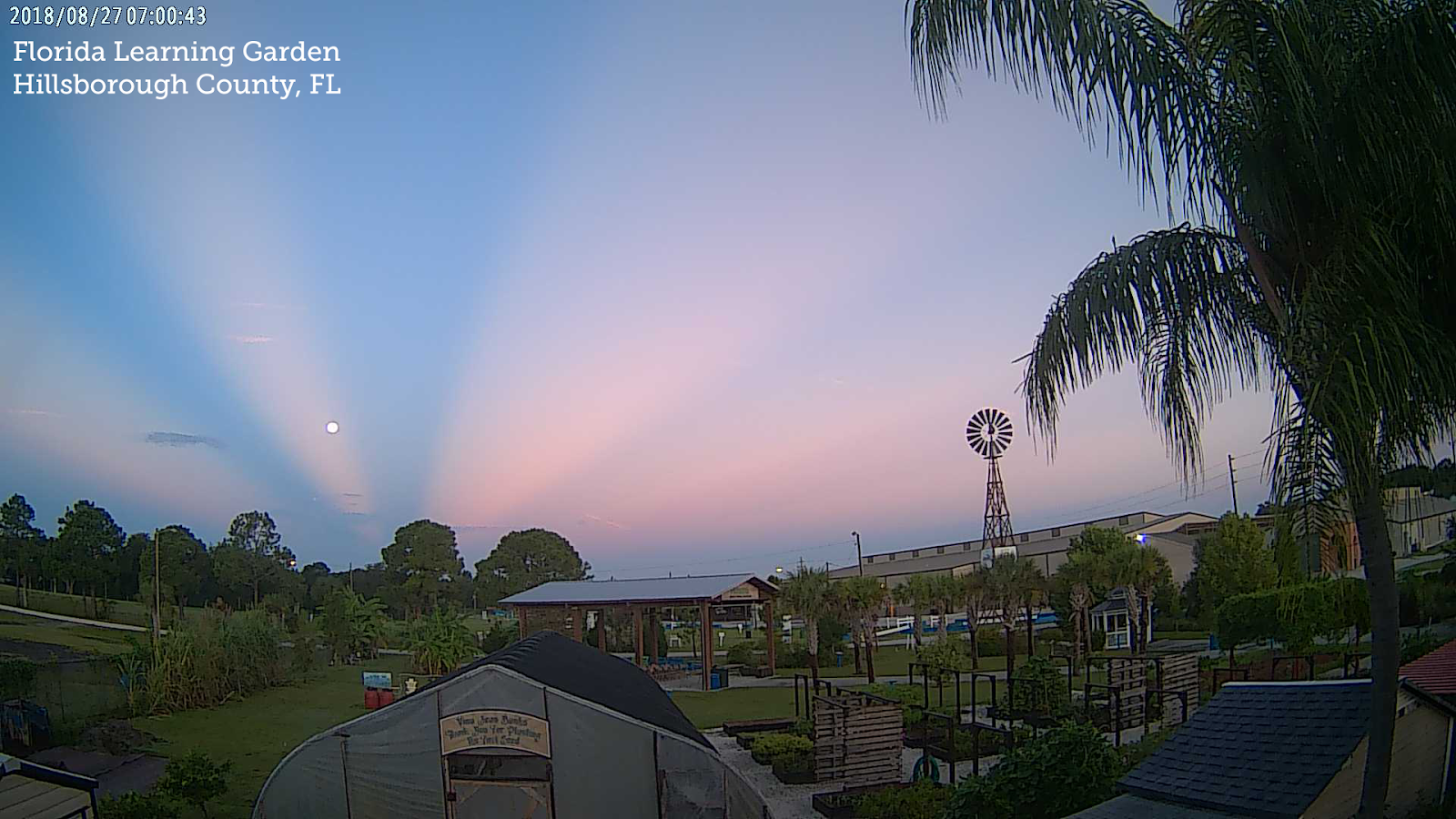
Sometimes called 'sunbeams,' these rays are seen from clouds during the crepuscular - or twilight - hours (we commonly refer to twilight periods like dawn and dusk). Even though they seem to converge at the sun, through a visual illusion known as perspective, the rays are parallel beams of light. Anticrepuscular rays appear to converge at a point opposite the sun, known as an antisolar point through a visual illusion known as a linear perspective. Like crepuscular rays, they are parallel columns of sunlight, often with dark shadowed areas that stream through clouds' gaps.
Otherwise known as a mock sun or parhelion, these bright spots are noticeable when there's a halo around the sun. Halos form when sunlight refracts due to a thin layer of high clouds (cirrus), composed mainly of ice crystals and are typically located about 22 degrees on either the left, right, or both sides of the sun. The colors usually go from red closest to the sun, out to blue outside the sundog. Sundogs are more commonly seen during the winter months due to the sun's angle to the Earth's surface.
