Hurricane Ian: Classification and Track
Source: Wikipedia | Hurricane Ian
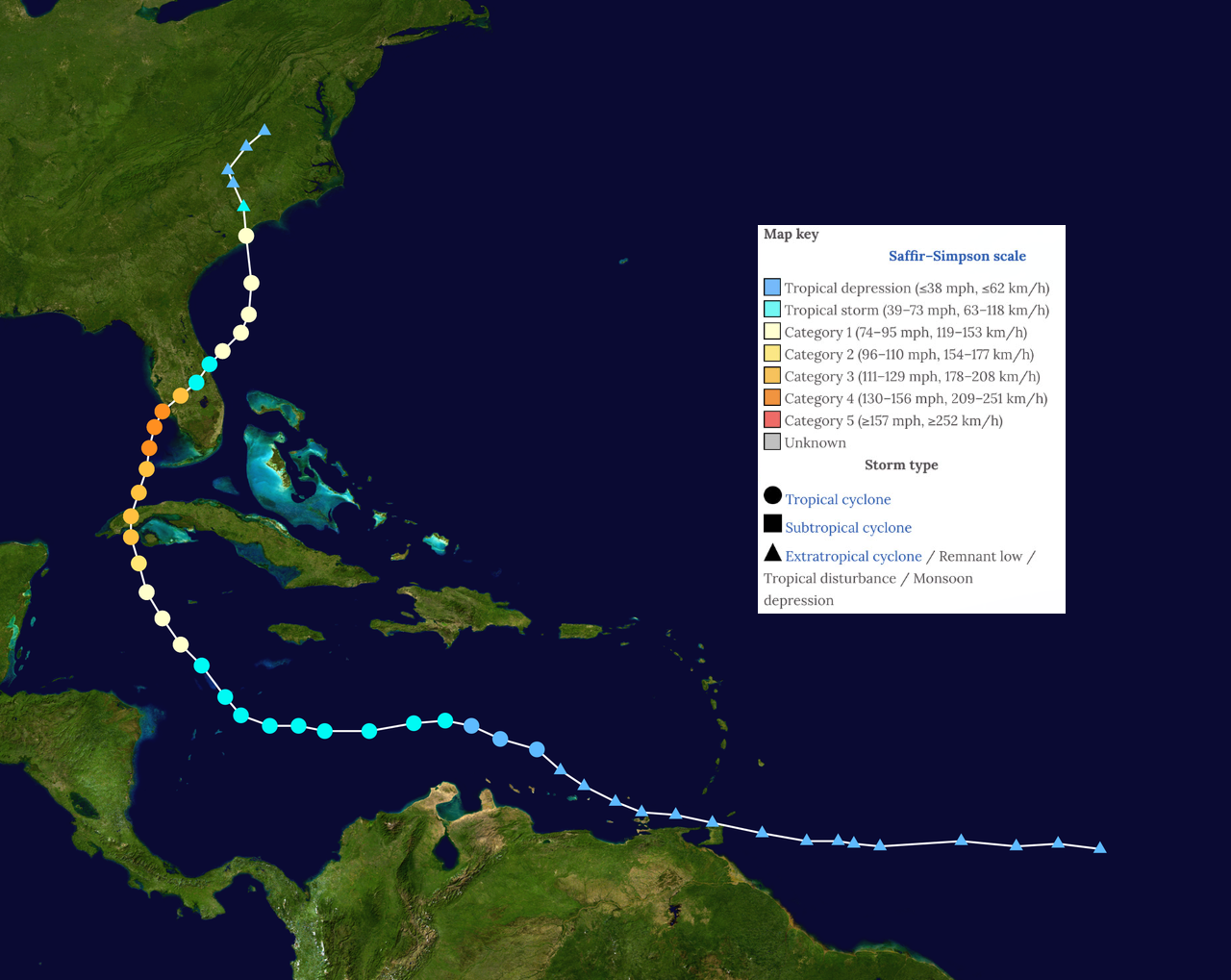
Hurricane Ian originated from a tropical wave that emerged off the coast of Africa on September 19. By September 21, the wave moved into the Caribbean Sea, producing heavy rain and gusty winds to Trinidad and Tobago and portions of the northern coast of South America. The wave became better organized, and a tropical depression formed on September 23 and intensified into a tropical storm the next day southeast of Jamaica.
The storm underwent the first of two rapid intensifications, becoming a Category 3 hurricane before it made its first of three landfalls in western Cuba on September 27. The hurricane only lost a small amount of energy and restrengthened when it emerged over the warm waters of the Gulf of Mexico. The storm moved to the north-northwest and underwent its second rapid intensification, becoming a powerful Category 4 hurricane as it approached the Southwest Florida coast. Hurricane made landfall on Cayo Coast, Florida, on the afternoon of September 28. The storm weakened from a Category 4 hurricane to a strong tropical storm as it tracked slowly across the Florida Peninsula. Late on September 29, the storm emerged off the Florida East Coast, near Cape Canaveral.
Ian restrengthened to a Category 1 hurricane and, on the morning of September 30, accelerated northward toward the South Carolina coast. The storm made its third landfall near Georgetown, South Carolina. The storm quickly weakened as it moved inland, transitioned to a post-tropical system three hours after landfall, and eventually dissipated over southern Virginia on October 2.