USGS High Water Marks
The United States Geological Survey (USGS) deployed dozens of water level sensors ahead of Hurricane Ian's landfall across the region. Unfortunately, most of them were lost or damaged due to the storm surge. Survey teams looked for high watermarks created by debris to help identify the height of floodwaters or storm surge. Preliminary data based on the post-storm survey conducted by USGS, FEMA, and members of NOAA suggest that the storm surge reached a height of 10 to 15 ft. in Fort Myers.
NOAA created an interactive map of before and after images along Hurricane Ian's path. Use the map to examine more of the damage caused by this historic storm.
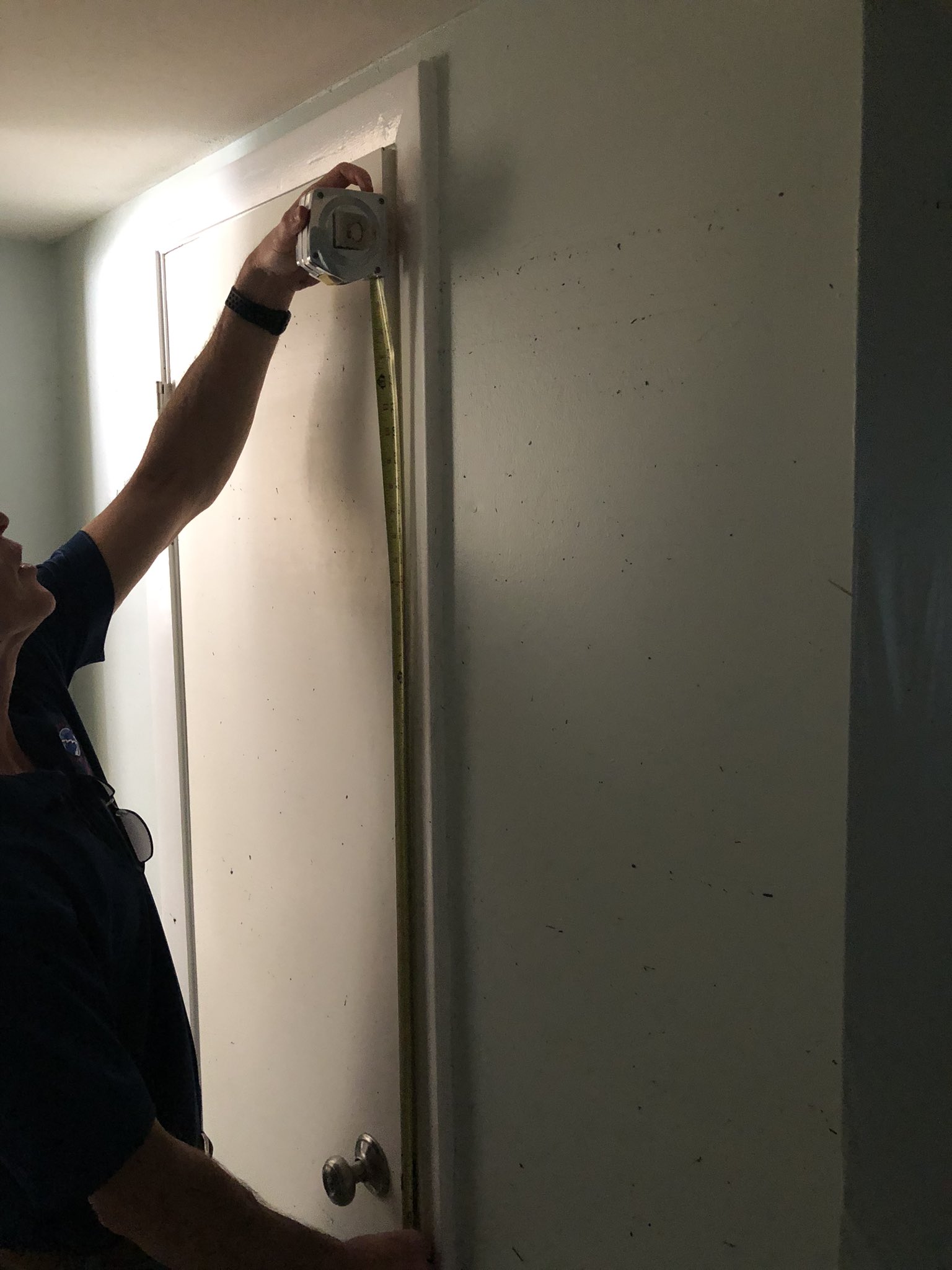
HWM survey today for #ian on Fort Myers Beach, San Carlos Island, Shell Point, Fort Myers with @NWSTampaBay @hcfcd @NHC_Atlantic Stillwater marks ranged from 10.0-15.5 ft above the ground level (MHHW). Damage equal to Micheal (2018) but over larger spatial area. From: Jeff Lindner | Twitter
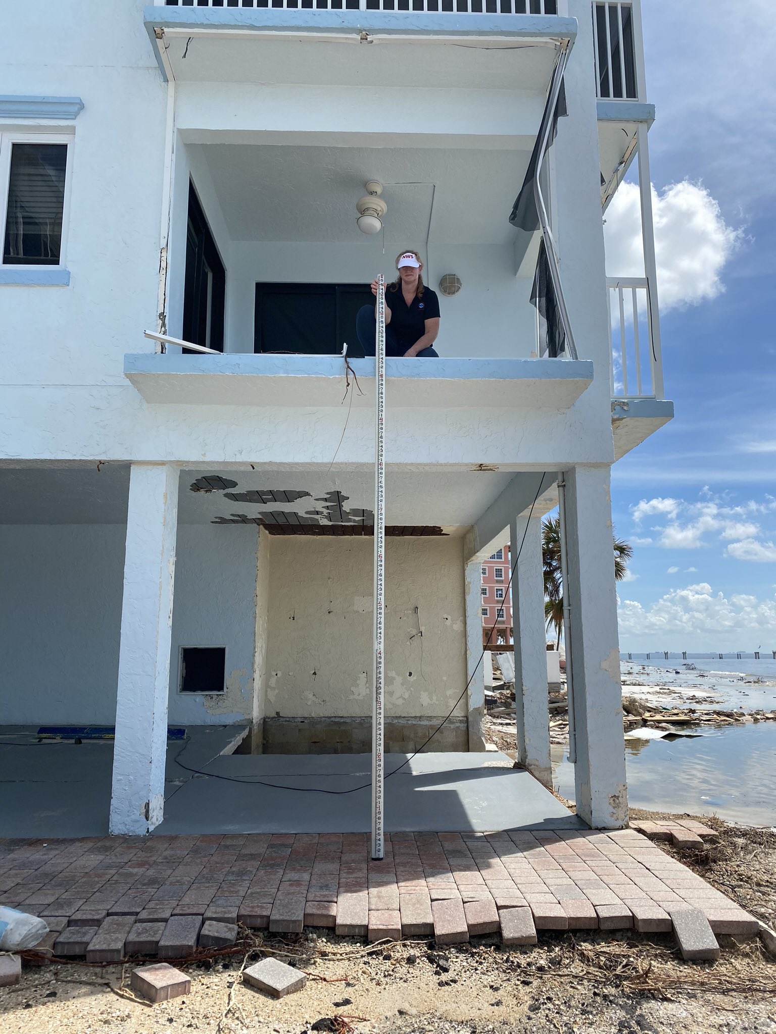
Some high surge values on Fort Myers Beach from yesterday’s survey. Over 15 foot high still marks above ground on the second floor. Most areas between 10-12’ above MHHW. Complete inundation of the island. #HurricaneIan @JeffLindner1 @NWSTampaBay From: Jeff Evans | Twitter
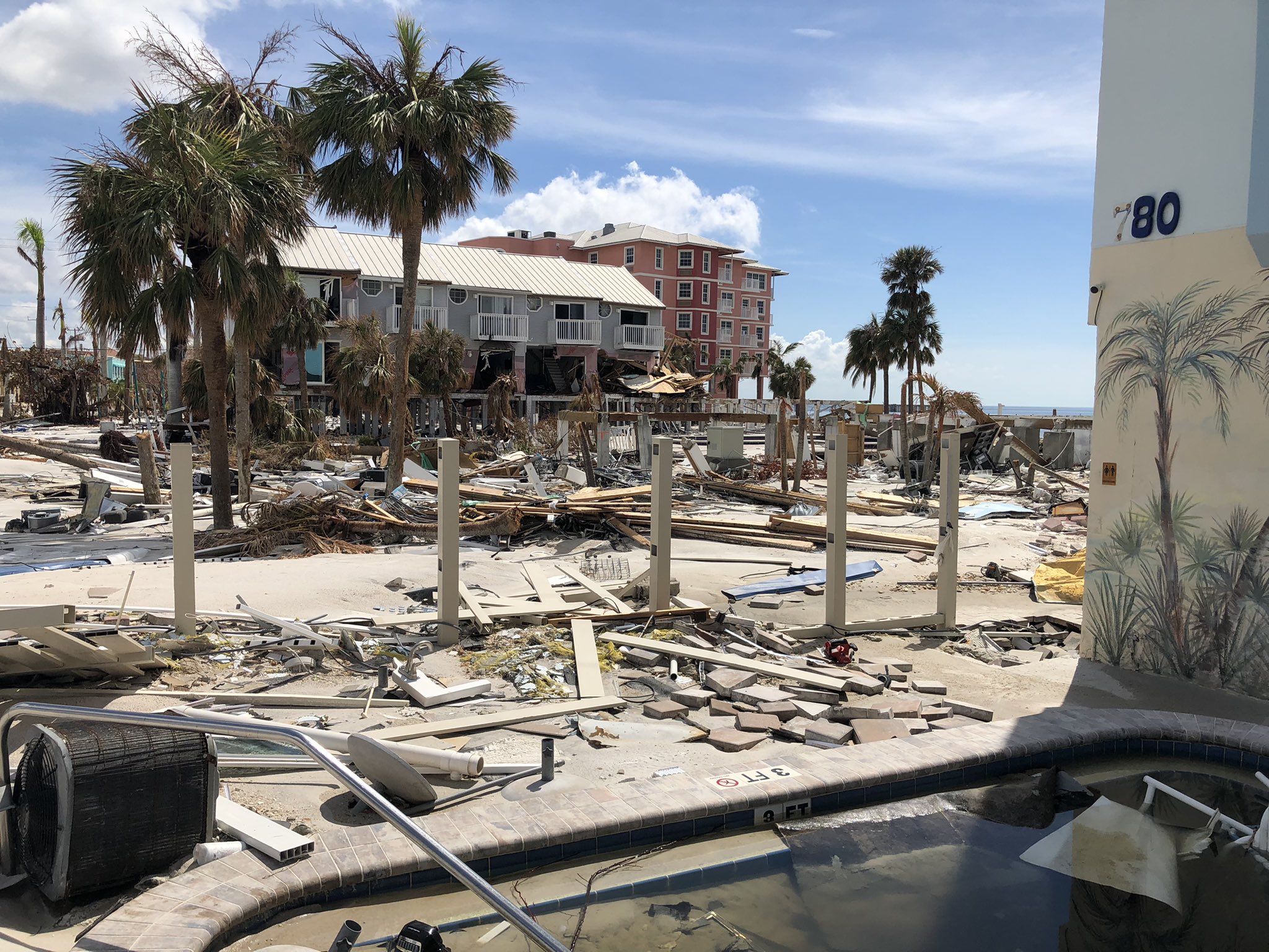
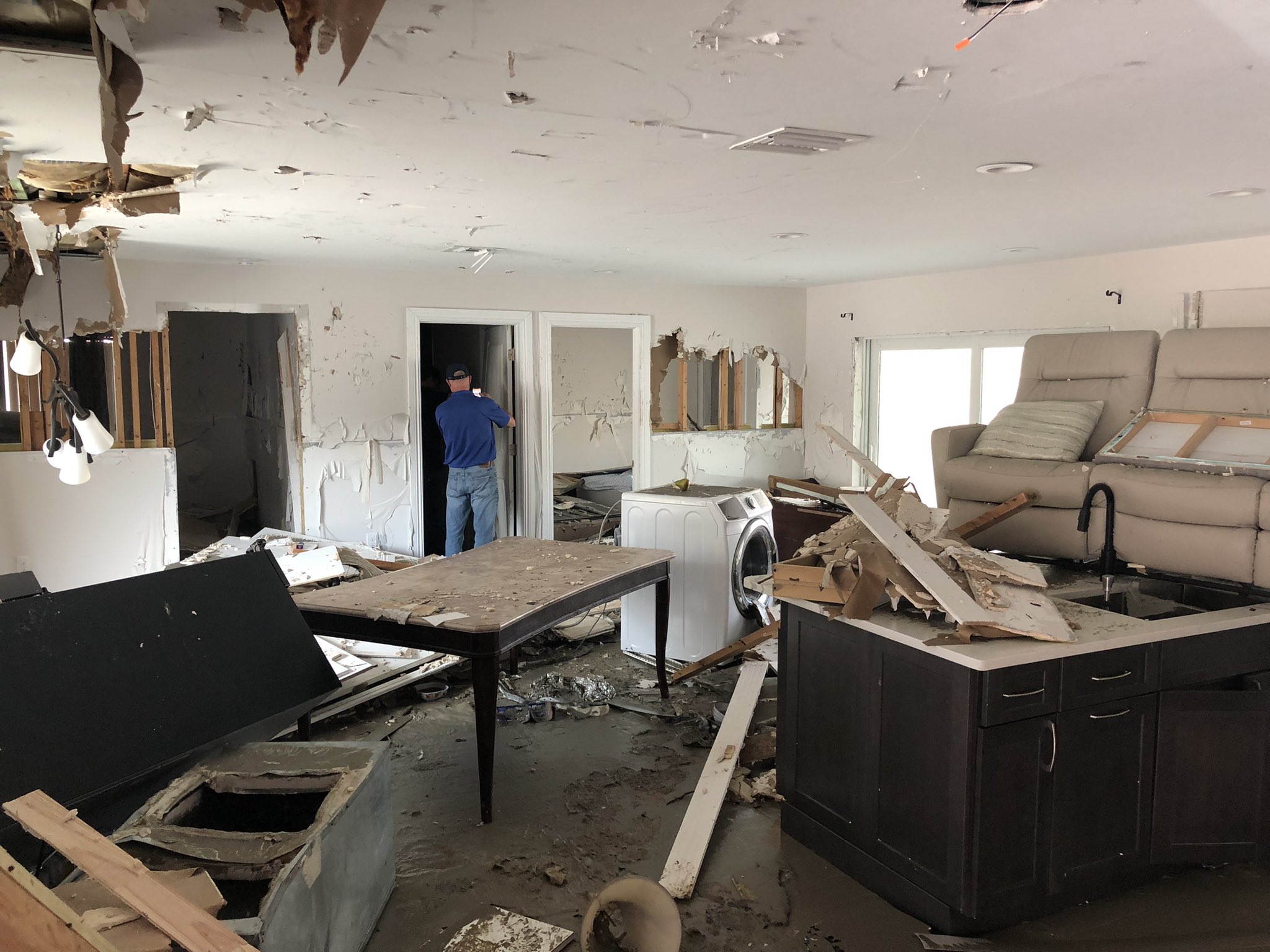
Complete destruction of structures generally at or below 10-12 ft on the beach side of Fort Myers Beach from storm surge, waves, and flow of surge. Significant scour and beach erosion with portions of the island almost cut in a few locations #ian From: Jeff Lindner | Twitter
#ian Day 2 storm surge survey on Bonita Beach. Average Stillwater marks 9.0-11.5 ft above ground level (MHHW). Significant scour of beach and inland sand movement @jeffryevans @NWSTampaBay @NHC_Atlantic From: Jeff Lindner | Twitter