Hurricane Ida: Track and Classification
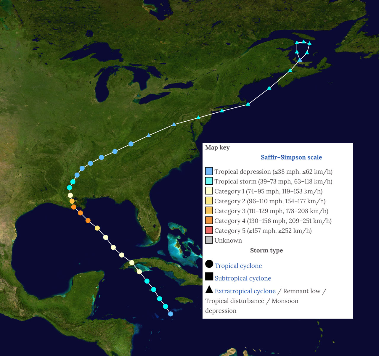
Ida developed from the combination of multiple weather systems, including a tropical wave that emerged off the coast of Africa on August 14 and a broad area of low pressure located along the northern coast of South America. By August 26, convection in the southwestern Caribbean Sea became better organized and a tropical depression formed near Jamaica.
The storm moved to the north-northwest, steered by the flow of the subtropical ridge, and the center of the storm passed by Grand Cayman on August 27, making landfall in Cuba that evening. Ida crossed into the Gulf of Mexico and underwent rapid intensification; maximum winds went from 70 knots (80 mph) to 130 knots (150 mph) within 24-hours. The storm moved northwestward and made landfall at Port Fourchon on August 29, LA, as a Category 4 Hurricane. Ida slowly tracked through Louisiana, taking nearly 12 hours before reaching the Louisiana/Mississippi state line.
The storm eventually weakened to a tropical storm as it moved through Mississippi before crossing into northwestern Alabama and eastern Tennessee on August 31. Ida became extratropical on September 1 after reaching West Virginia and then entered central Maryland and southeastern Pennsylvania. On early September 2, the storm's center tracked across Long Island, New York, before eventually dissipating near the southern Massachusetts coast.