Storm Surge
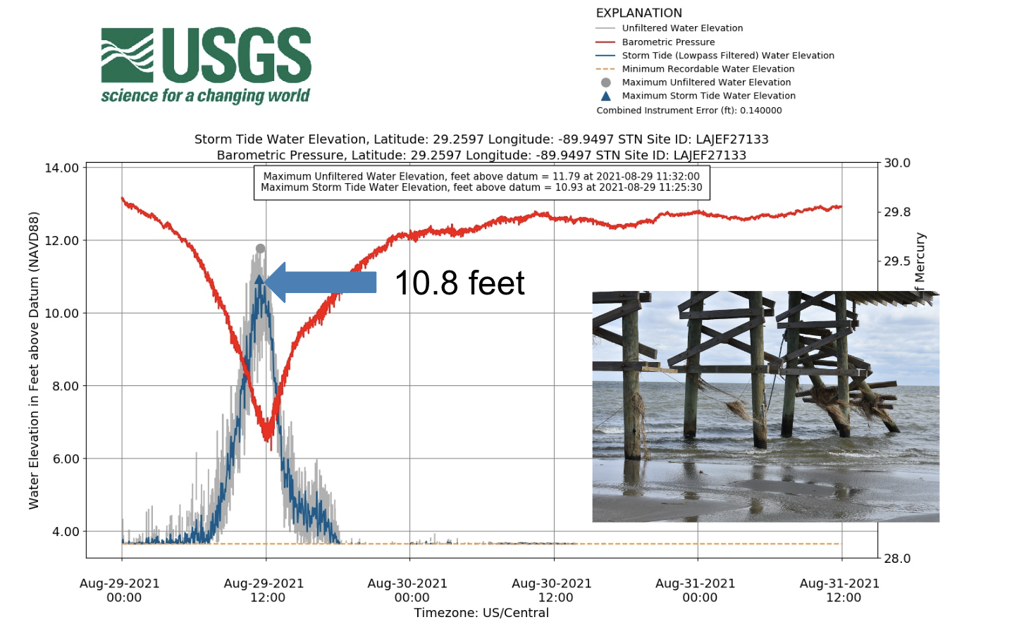
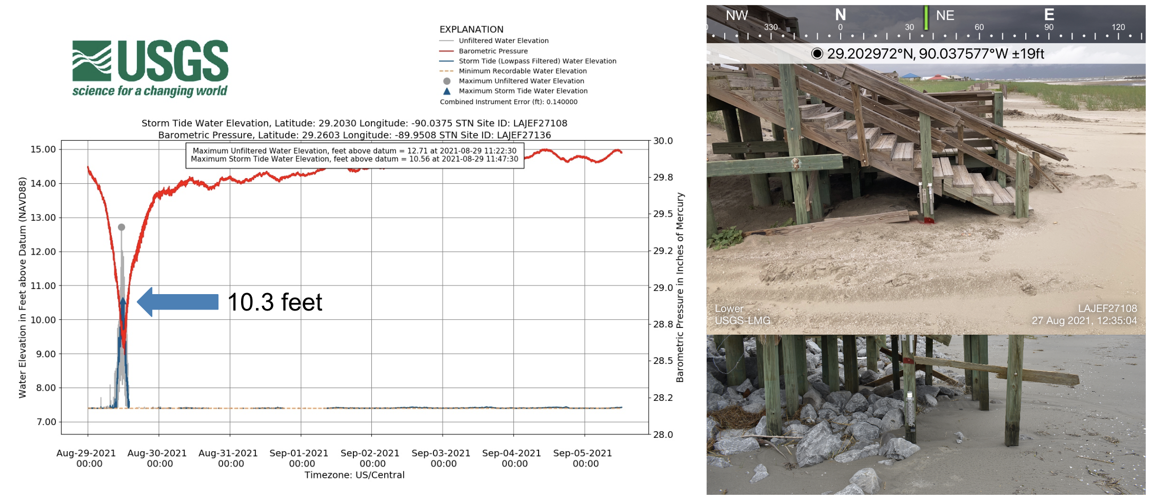
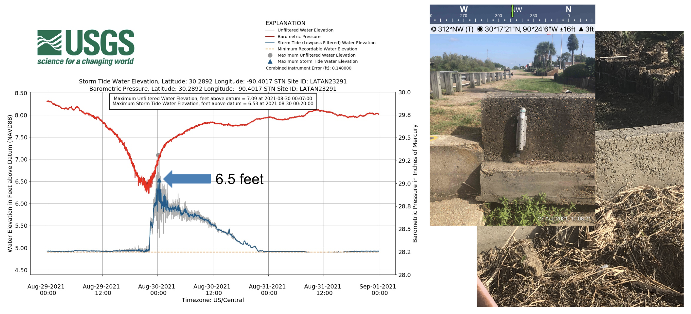
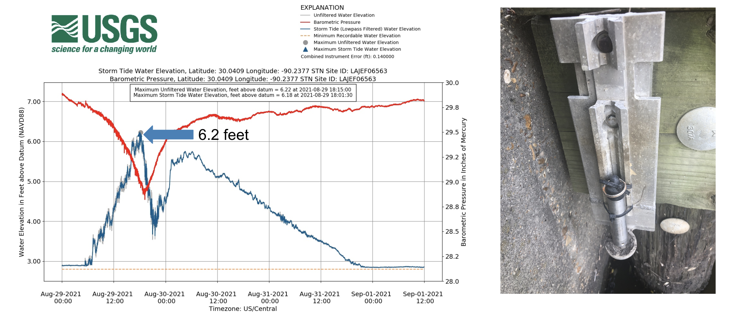
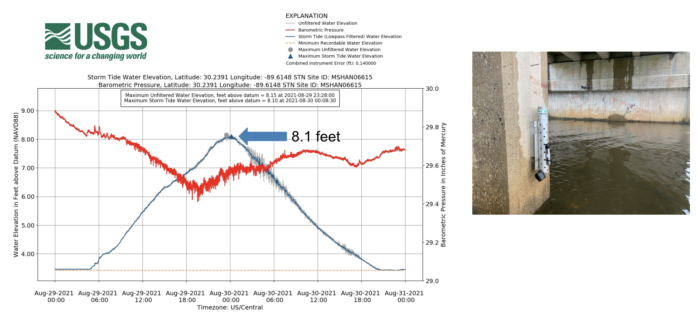
The United States Geological Survey (USGS) deployed dozens of water level sensors ahead of Hurricane Ida's landfall across the region. The sensors measure water level data and barometric pressure at 30-second intervals. They are a point of verification, in addition to looking for high watermarks created by debris to help identify the height of floodwaters or storm surge. Data based on the post-storm survey conducted by USGS, FEMA, and members of NOAA suggest that the storm surge reached a height of 10.8 ft. in Grand Isle, LA.
NOAA created an interactive map (https://storms.ngs.noaa.gov/storms/ida/index.html#13/29.8529/-90.0307) of before and after images along Hurricane Ida's path. Use the map to examine more of the damage caused by this historic storm.